Climate change has been a hot topic on land and in the air for some time now. We have data that tells us what’s happening. We have images of polar bears stuck on drifting ice that melted to a nub. We can feel the heat (and cold), smell the quality of the air, and see the statistics that show us something is going awry in nature.
We have only been able to skim the surface for the most part when it comes to the seas. The Catlin Seaview Survey seeks to change that.
With the help of Google, the organizations wants to establish a 360 degree panoramic vision of the full 2400km stretch of the Great Barrier Reff and Coral Sea to a depth of 100 meters. The survey will have three major components and will attempt to shed light on the health of one of the richest beds of life the world knows.
“The Catlin Seaview Survey comprises a series of studies, which will reveal to the public one of the last frontiers on Earth: the oceans,” chief scientist for the project Ove Hoegh-Guldberg said. “For the first time in history, we have the technology available to broadcast the findings and expedition through Google.”

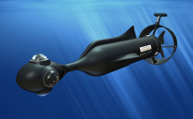
There won’t be any Street View Cars going into the deep. A specially-designed SVII Camera (pictured above) is being designed to start filming in September, 2012. There have been challenges with the fluid dynamics of the camera, but these problems have been addressed by utilizing the natural design of sharks to work properly in the extreme conditions that exist that deep in the ocean.


